Science challenge
In order to manage UK land for a carbon neutral future and net biodiversity gain, detailed, accurate knowledge of the land surface is essential.
Project summary
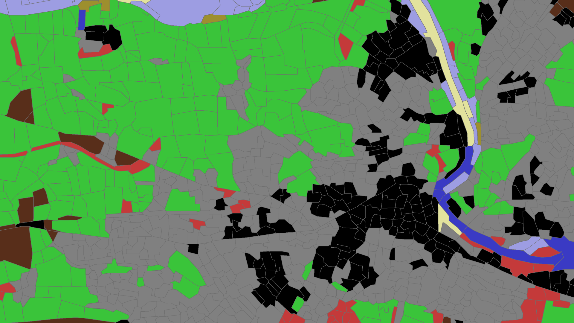
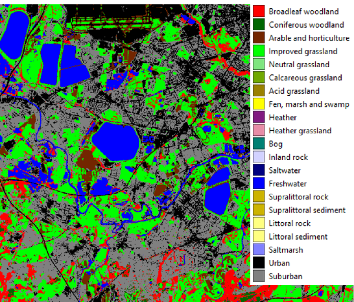
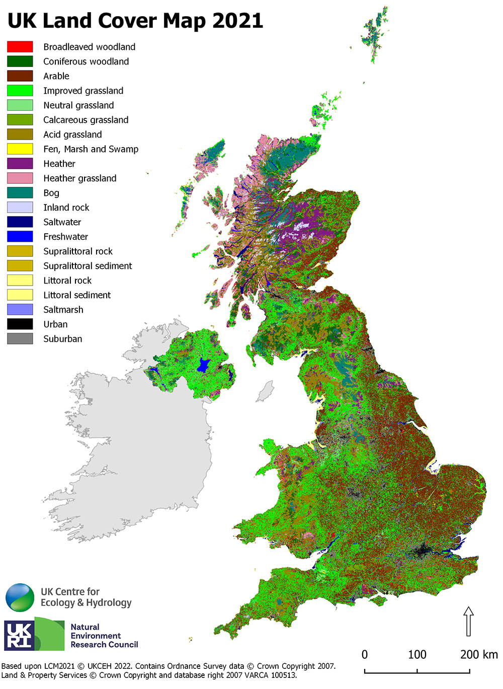
UKCEH's Land Cover Map (LCM) is an uninterrupted national dataset of land cover classes from grassland, woodland and fresh water to urban and suburban built-up areas. The maps provide essential information for government agencies, water companies, land managers, NGOs and researchers about the state of the British landscape, locally or nationally, and how it is changing. Knowing what habitats there are, and where, is crucial for planning developments and environmental improvements.
To create the Land Cover Map, we use time series of satellite data, mostly obtained from the Google Earth Engine. This spatial data is integrated with training data, automatically derived from our historical series of Land Cover Maps, and a machine learning algorithm, to produce a new map. Therefore each new map is produced from the previous one in a process known as bootstrap training. To ensure good quality land cover products we produce a new map every year.
Validation of the Land Cover Map product is carried out by systematic visual inspection using online image resources and harvesting data from a wide range of other field activities. The UK-SCAPE Land Cover team actively engages with field-based surveying communities through the UK Environmental Observation Framework to advise and encourage data collection suitable for satellite-based vegetation assessments.
 The following products and associated data sets have been produced so far. The project will produce a new land cover map every year. In addition we are developing advanced methods for creating our land cover maps: