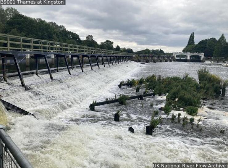
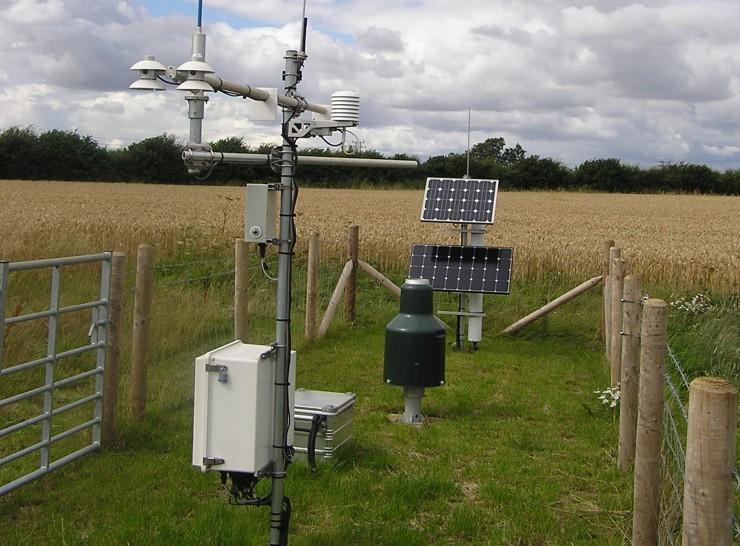
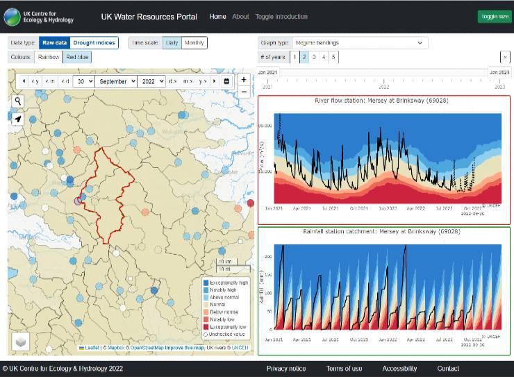
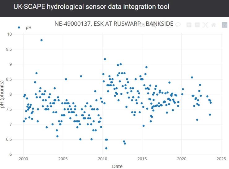
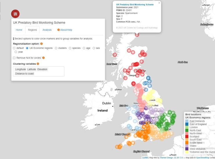
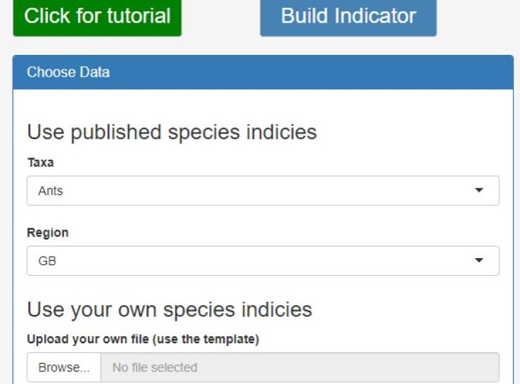
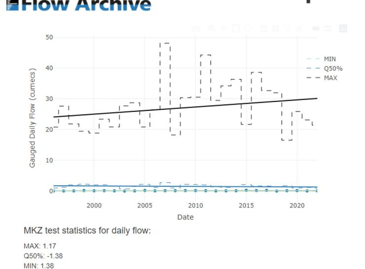
Virtual Survey Lab

Science challenge

The ability to efficiently access and analyse datasets from many sources is essential to gain an holistic understanding of environmental processes and change. The Virtual Survey Lab will support environmental research by bringing together data collected both within the UK-SCAPE programme and by external partners.

    Data integration examples

    Project summary

    The Virtual Survey Lab will marshal a wide range of data, models, analytical and informatics tools to enable researchers and stakeholders to access, exploit and enhance these elements as a harmonised research resource. It will provide integrated access to a wide range of data collected both by UKCEH and collaborating organisations. Alongside these data will be a suite of tools enabling users to work with and analyse the data, including for spatial upscaling, modelling data from multiple sources and exploring uncertainty in process-based models. As well as datasets and analytical tools, we will also generate maps of the current status of key environmental indicators across the UK. The Virtual Survey Lab will be one of several Virtual Data Labs that are component of the developing UKCEH Data Science Framework.

    Objectives

    • To develop the components of a Data Science Framework (DSF) required to produce integrated data products utilising the data collected within the UK-SCAPE program and from external sources.
    • To develop statistical routines to analyse data across different spatial and temporal scales and from different sources to produce a series of highly resolved spatio-temporal data products.
    • To make these products discoverable and accessible to the wider scientific community  and prioritised to address questions and fill gaps in other areas of the UK-SCAPE programme.
    • To test the efficiency of ongoing monitoring and, in the context of answering specific questions, highlight where we should direct monitoring campaigns and prioritise effort.
    • To provide a platform for the integration of monitoring data provided by a range of partners from across terrestrial, atmospheric and freshwater habitats.

      Interactions

      UKCEH national capability

      • The methodological development work within this task links across to other NC activity, e.g.:
        • Methods on spatial upscaling and extrapolation link to work in ASSIST on mapping pesticide/insecticide usage
        • Spatio-temporal modelling of complex biological processes links to work on mapping pathogens within the NC ODA Sunrise project
        • Data assimilation approaches and combining data from multiple sources will be used within the Hydro-JULES programme
      • The tools for programmatic access to data also link with activity within the NC data project
      • Work on automated QA approaches and multivariate extreme value analysis will link to the long term monitoring conducted within UK-SCAPE
      • Data products developed as part of this task will be used throughout UKCEH’s NC portfolio to enable modelling at unprecedented spatial and temporal scales leading to greater understanding. For example:
        • Maps of key soil properties that will be used within UK-SCAPE’s SPEED project for inputs into the pollution modelling work
        • Inputs into the UK-SCAPE SOC-D project for modelling soil organic carbon
      • without the upscaling and production of data products from this task, these activities could not happen

      Partnerships

      • The Virtual Survey Lab will provide a platform for the NERC community, policy and business users to access, integrate and query environmental data sets like never before.

      Project Lead: Pete Henrys