COSMOS-UK site - Balruddery
COSMOS-UK

Science challenge

Whilst the UK has a long history and well-established tradition of monitoring meteorological and hydrometeorological variables, soil moisture (SM) has until recently been difficult to measure cost-effectively and at a scale appropriate to many applications. An understanding of real-time SM is crucial in flood forecasting, drought management, land-use planning, agricultural development and water resource development. COSMOS-UK bridges the spatial gap between small and large-area sensors, providing accurate SM information for input into models as well as informing local planning.

Project summary

Established in 2013, the COSMOS-UK project currently operates a network of over 50 stations installed across the UK. The project is still developing in terms of the network and services offered to users. 

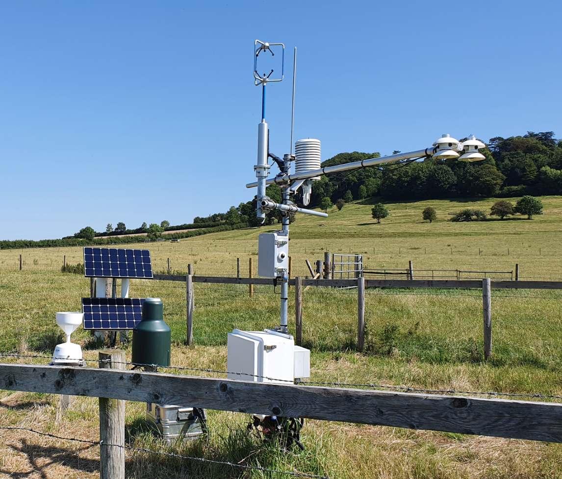
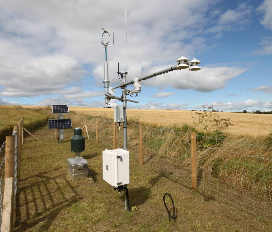
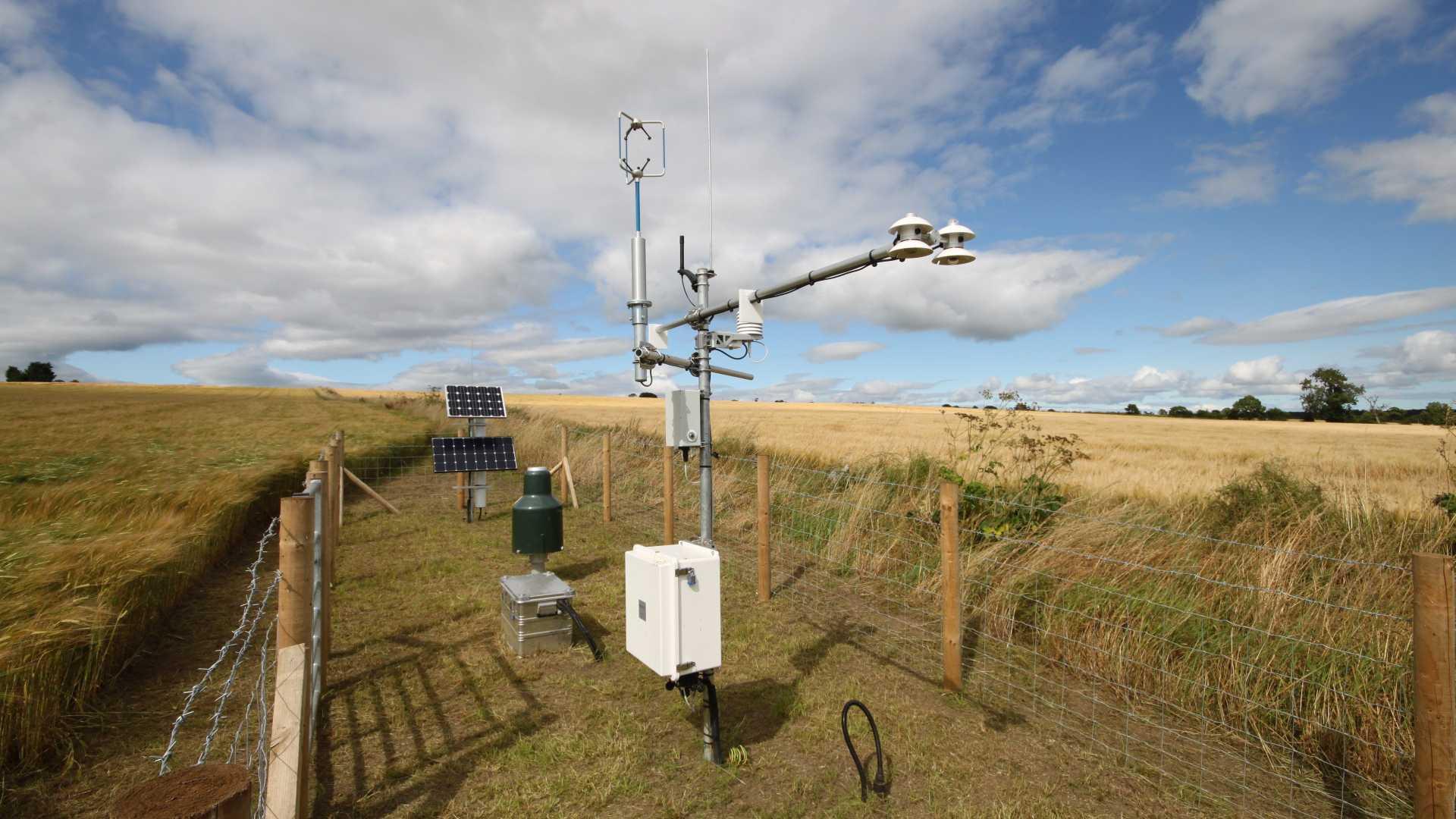
The primary purpose of the COSMOS-UK project is to deliver soil moisture data in near-real time across the UK. The innovation provided by COSMOS-UK comes from the use of a sensor that exploits cosmic-rays to measure soil moisture over an area of about 12 hectares. The sensor sits above ground and operates automatically to deliver data from remote sites. This contrasts with other sensors that are intrusive, effectively point-scale, or require an on-site operator.

It is anticipated that publicly accessible real-time data will empower all kinds of applied environmental research: more accurate meteorological models; better water resource information of current and future conditions; increased resilience to natural hazards, for example by earlier flood warnings; improved water use efficiency in crop production and give better crop yield forecasts. It will enable a step change in fundamental science, particularly meteorological predictability associated with soil moisture, and better models of greenhouse gas emissions from soils.

The project is supported by the Natural Environment Research Council award number NE/R016429/1 as part of the UK-SCAPE programme delivering National Capability.

Objectives

  • To secure and maintain access to a network of field sites across the UK, including developing and maintaining relationships with site hosts
  • To ensure data acquisition through routine and responsive maintenance of the field sites, and maintenance of in-house IT systems to retrieve the data from the field, and add to database
  • To undertake a continuous quality review of data, including adoption of new reviewed/revised quality control processes and reporting of data completeness
  • To deliver data and derived products for users, including ongoing ingestion into EIDC, handling ad hoc data requests and near-real-time data delivery via the COSMOS-UK website
  • To review its communications plan and make enhancements to its website and explore integration of COSMOS-UK data into the National Hydrological Monitoring Programme (Hydrological Summary), and enhance the COSMOS-UK contribution to the UKCEH Water Resources Portal
  • To enhance methodologies, notably in the derivation of soil moisture from 'cosmos' sensors. Also, to co-develop new UKCEH soil moisture products with other parts of UKSCAPE, and operationalise a UK gridded soil moisture data product.

Resources

Papers and outputs

Communication and presentations

Further information

Further information about the project can be located on the COSMOS-UK website. The website includes information on publications, collaborations and a full description of all COSMOS-UK sites.

Data

Data are published annually and available on the EIDC e.g. Stanley, S, Antoniou, V, Askquith-Ellis, A, Ball, L A, Bennett, E S, Blake, J R, Boorman, D B, Brooks, M, Clarke, M, Cooper, H M, Cowan, N, Cumming, A, Evans, J G, Farrand, P, Fry, M, Hitt, O E, Lord, W D, Morrison, R, Nash, G V, Rylett, D, Scarlett, P M, Swain, O D, Szczykulska, M, Thornton, J L, Trill, E J, Warwick, A C, Winterbourn, B. 2021. Daily and sub-daily hydrometeorological and soil data (2013-2019) [COSMOS-UK]. NERC Environmental Information Data Centre. (Dataset). DOI: 10.5285/b5c190e4-e35d-40ea-8fbe-598da03a1185

Infrastructure and facilities

COSMOS-UK has established a unique infrastructure of over 50 field sites with long-term access agreements with site hosts. In addition to this distributed infrastructure, COSMOS-UK has established data retrieval, checking and processing that provides viewing of the data in near real time of the project’s website.

Interactions

UKCEH national capability

  • HydroJULES: COSMOS-UK data underpin a number of activities within HydroJULES
  • SUNRISE: Technologies developed within COSMOS-UK are enabling activities within SUNRISE.

Support for UK science

  • COSMOS-UK data are published by and downloadable from EIDC as noted above, under an Open Government Licence
  • Ad hoc requests for additional data are considered on a case by case basis and as of March 2021 close to 400 such requests have been addressed
  • Informal collaborations exist with a number of UK organisations and universities, including the enabling of under-graduate and post-graduate research projects
  • Data and expertise derived by COSMOS-UK have also led to new funding opportunities.

International engagement

  • COSMOS-UK participates in the international COSMOS network of researchers exploiting the cosmic-ray neutron method of monitoring soil moisture.
  • COSMOS-UK is an active participant in the COSMOS-Europe data integration/comparison initiative.
  • Data have been supplied to universities and researchers outside the UK.

Project lead - Jon Evans